Technology
NASA shares first air pollution data maps from space
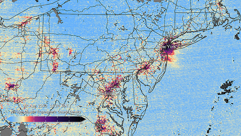
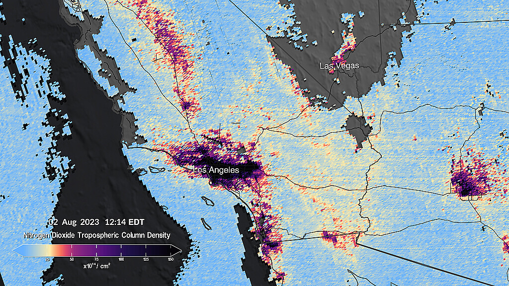
The initial pollution maps that were released, reveal pollution patterns around cities and major transportation routes across North America

August 24, 2023 10:16pm
Updated: August 24, 2023 10:16pm
NASA unveiled groundbreaking data maps on Thursday, transmitted from its recently launched space instrument monitoring major air pollutants across North America.
Launched earlier this year and hovering 22,000 miles above the equator, Tropospheric Emissions: Monitoring of Pollution (TEMPO) is now providing high-resolution insights into air quality. The initial pollution maps that were released, reveal pollution patterns around cities and major transportation routes across North America.
The instrument marks a significant advancement as the first space-based tool designed to continuously monitor air quality over North America with unprecedented detail, mapping regions as small as a few square miles.
“Neighborhoods and communities across the country will benefit from TEMPO’s game-changing data for decades to come," said NASA Administrator Bill Nelson.
"This summer, millions of Americans felt firsthand the effect of smoke from forest fires on our health. NASA and the Biden-Harris Administration are committed to making it easier for everyday Americans and decision-makers to access and use TEMPO data to monitor and improve the quality of the air we breathe, benefitting life here on Earth,” he added.

TEMPO's observations promise to enhance studies on pollution stemming from rush-hour traffic, wildfire smoke dispersion, volcanic ash movement, and agricultural practices. Furthermore, the data will facilitate assessments of the health impacts of pollutants and aid in creating detailed air pollution maps to identify disparities in air quality within communities.
The findings will be shared with partner agencies such as the Environmental Protection Agency and the National Oceanic and Atmospheric Administration, to further quality monitoring efforts.
Launched aboard a Maxar Intelsat 40e satellite via a SpaceX Falcon 9 rocket in April, TEMPO scans the lower atmosphere above North America every hour during daylight.
Stretching from the Atlantic Ocean to the Pacific coast and from Mexico City to central Canada, the instrument employs a sophisticated spectrometer to detect pollutants that are normally concealed within sunlight reflections.
The TEMPO mission is a collaborative effort between NASA and the Smithsonian Astrophysical Observatory (SAO) in Cambridge, Massachusetts.


