Climate
Southern Peru coastline rocked by powerful 7.2 magnitude earthquake, tsunami alerts canceled
According to the United States Geological Survey, the earthquake occurred at a depth of 17 miles

June 28, 2024 10:32am
Updated: June 29, 2024 8:15pm
A magnitude 7.2 earthquake rocked southern Peru early this Friday in the Arequipa region, whose capital is the second most populated city in the country, leaving 8 people injured, according to the United States Geological Survey (USGC). It’s epicenter was reportedly five miles from Atiquipa, which is located 372 miles south of the capital Lima.
According to a report published by USGC, the earthquake occurred at a depth of 28 kilometers (17 miles), and the Geophysical Institute of Peru (IGP) said the quake struck with an epicenter 54 kilometers southwest of the coastal district of Yauca, where two magnitude 5 earthquakes occurred last Saturday.
The movement had an intensity of VI on the Modified Mercalli Intensity Scale, which implies that it was perceived as “strong” by the inhabitants of the area.
“The intensity scale consists of a series of certain key responses such as people awakening, movement of furniture, damage to chimneys, and finally—total destruction,” a USGC report explains.
“The Modified Mercalli Intensity value assigned to a specific site after an earthquake has a more meaningful measure of severity to the nonscientist than the magnitude because intensity refers to the effects actually experienced at that place.”
🎒 Ante el #sismo ocurrido en #Arequipa, recuerda que es importante tener lista tu mochila para emergencias. pic.twitter.com/RcmtMg9G7d
— Gobierno del Perú 🇵🇪 (@GobiernoPeru_) June 28, 2024
To that end, the effects of the quake were also felt, although in a noticeably lighter way, in Lima, where a third of Peruvians live.
Eight people were injured in the incident, according to Peruvian authorities. Five were medically treated at two Ica regional area hospitals and three were treated for minor injuries at a hospital in the neighboring Arequipa region, both in southwestern Peru, according to the national the ministry of health.
Prime Minister, Gustavo Adrianzen said no one died in the incident.
“We are just finishing analyzing the preliminary reports which tell us that there are no deaths, and we are monitoring the impact on infrastructures,” Adrianzen told radio RPP, according to Andina, the Peruvian news agency.
An X account registered to the office of the Peruvian Presidency reported on the social media platform that the government is continuing to take precautionary measures while it assesses the damage.
Shortly after the earthquake, the Directorate of Hydrography and Navigation of the Peruvian Navy issued a tsunami warning for 1 to 3 meter waves along the Peru coast, but it was subsequently canceled.
The Pacific Tsunami Warning Center (PTWC) also initially issued an alert warning of “possible” tsunami waves reaching up to from aftershocks, but also canceled the alert.
“There is no longer a tsunami threat from this earthquake,” the PTWC reported.
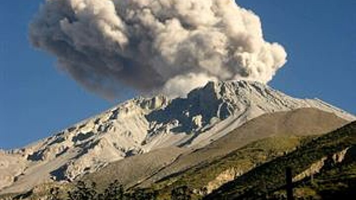
Peru, and most of the South American Pacific Coast, are on border of two tectonic plates known as the Pacific Ring of Fire or the Circum-Pacific Belt, where there are a high number of active volcanoes and earthquakes.
More than 80% of the world's seismic activity occurs in the region, largely due to shifting of two major tectonic plates. The South American continental plate includes most of the continent, and the Nazca plate extends across the Pacific along most of the coast.
“Seventy-five percent of Earth’s volcanoes—more than 450 volcanoes—are located along the Ring of Fire. Ninety percent of Earth’s earthquakes occur along its path, including the planet’s most violent and dramatic seismic events,” reports National Geographic in an encyclopedic entry it has published about the region online.
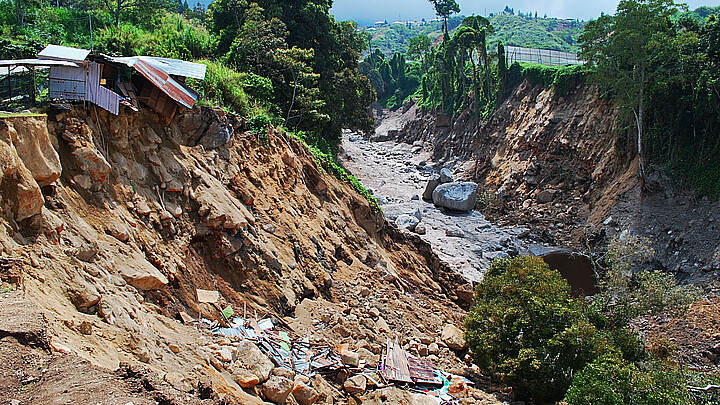
The last devastating earthquake in the country occurred off the coastal city of Pisco in August 2007 when a 8.0 magnitude earthquake hit that town and the entire southern region of Ica, leaving more than 500 dead.
The quake, which the Earthquake Engineering Research Institute (EERI) reported was the result of seismic subduction between the Nazca plate and the South American continental plate, also caused multi-million-dollar losses in housing and other infrastructure.